
Productomschrijving
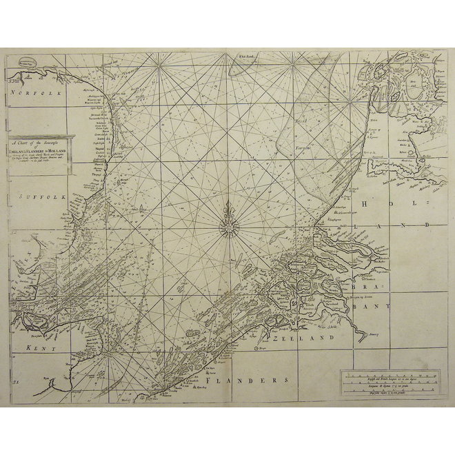
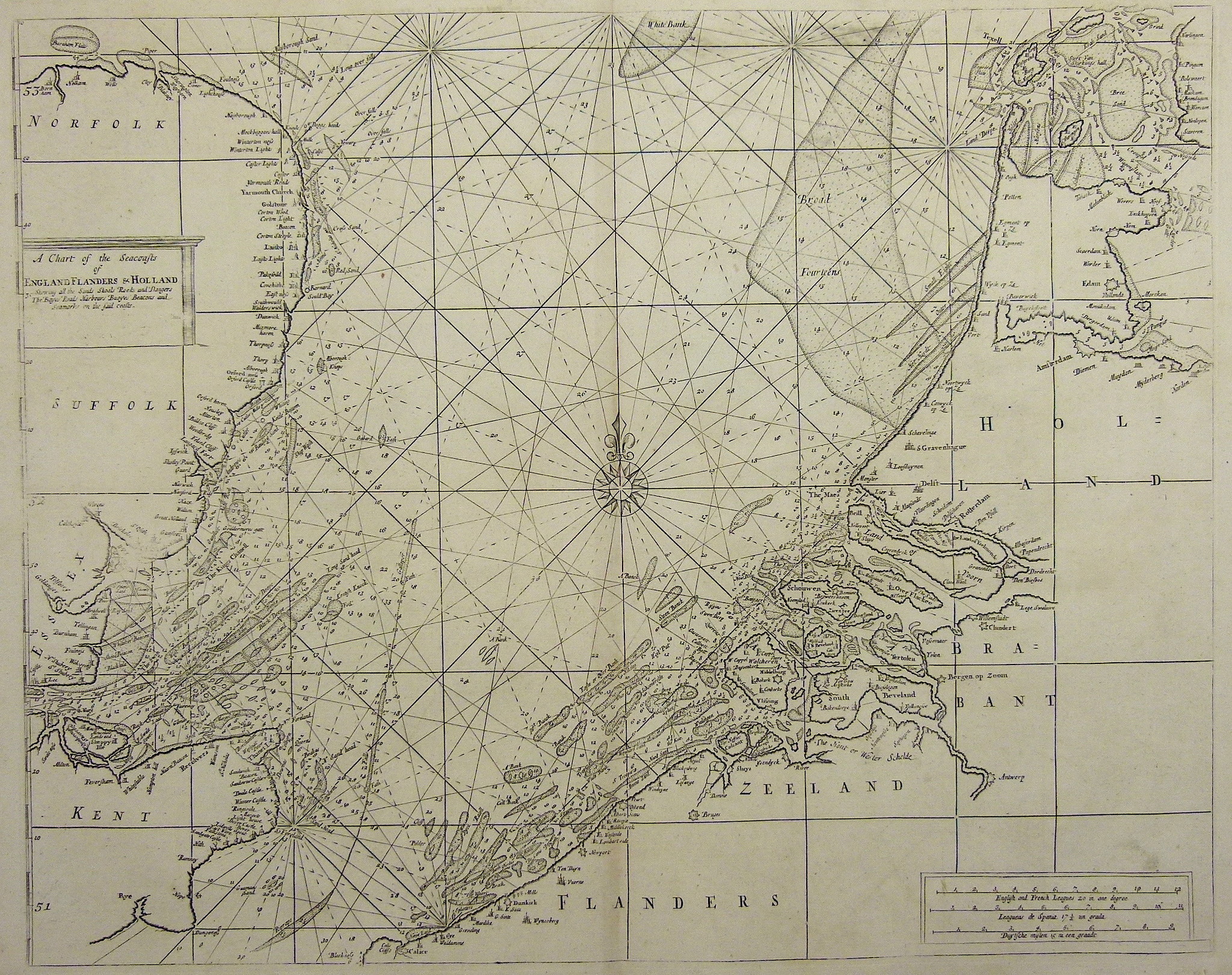
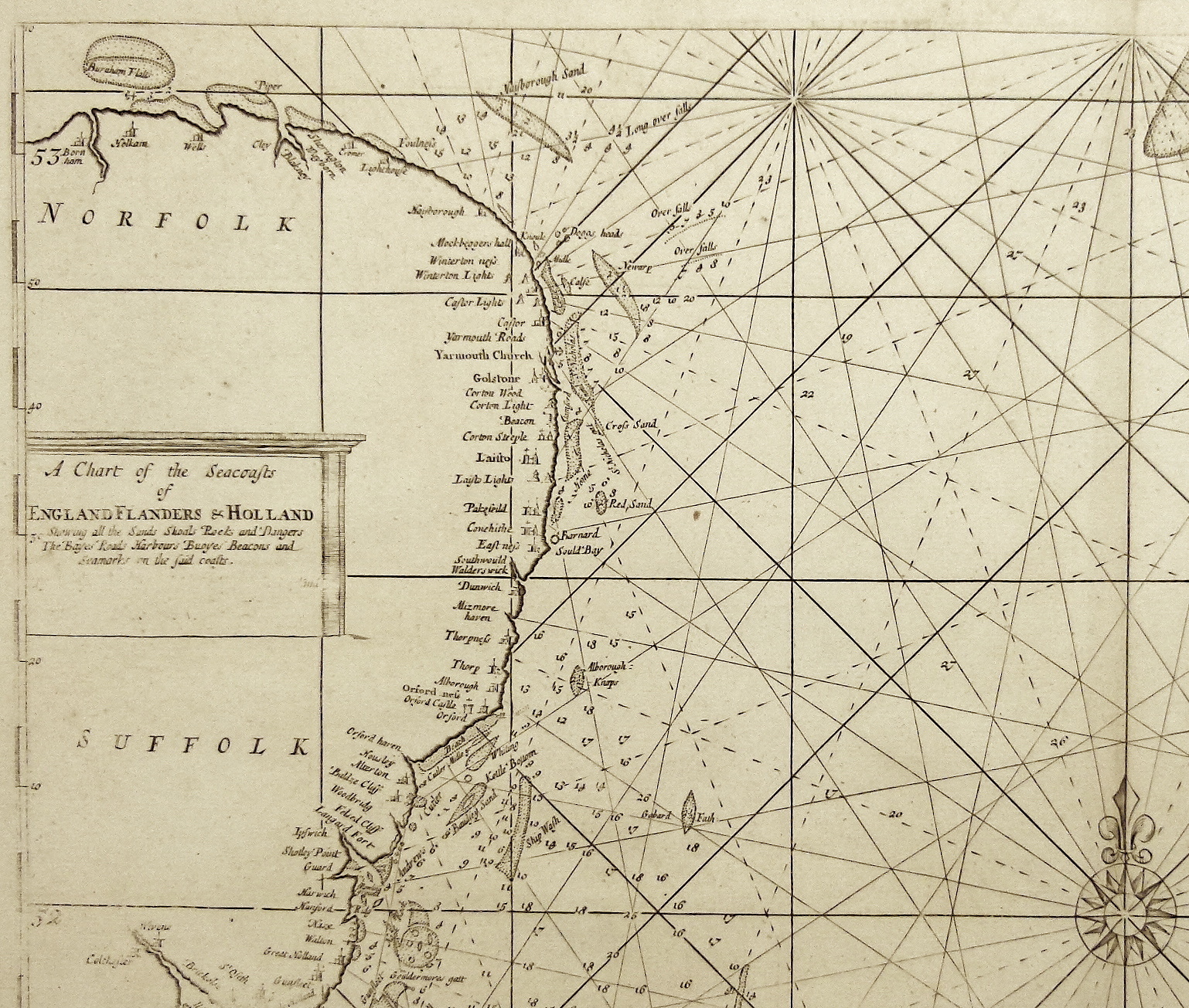
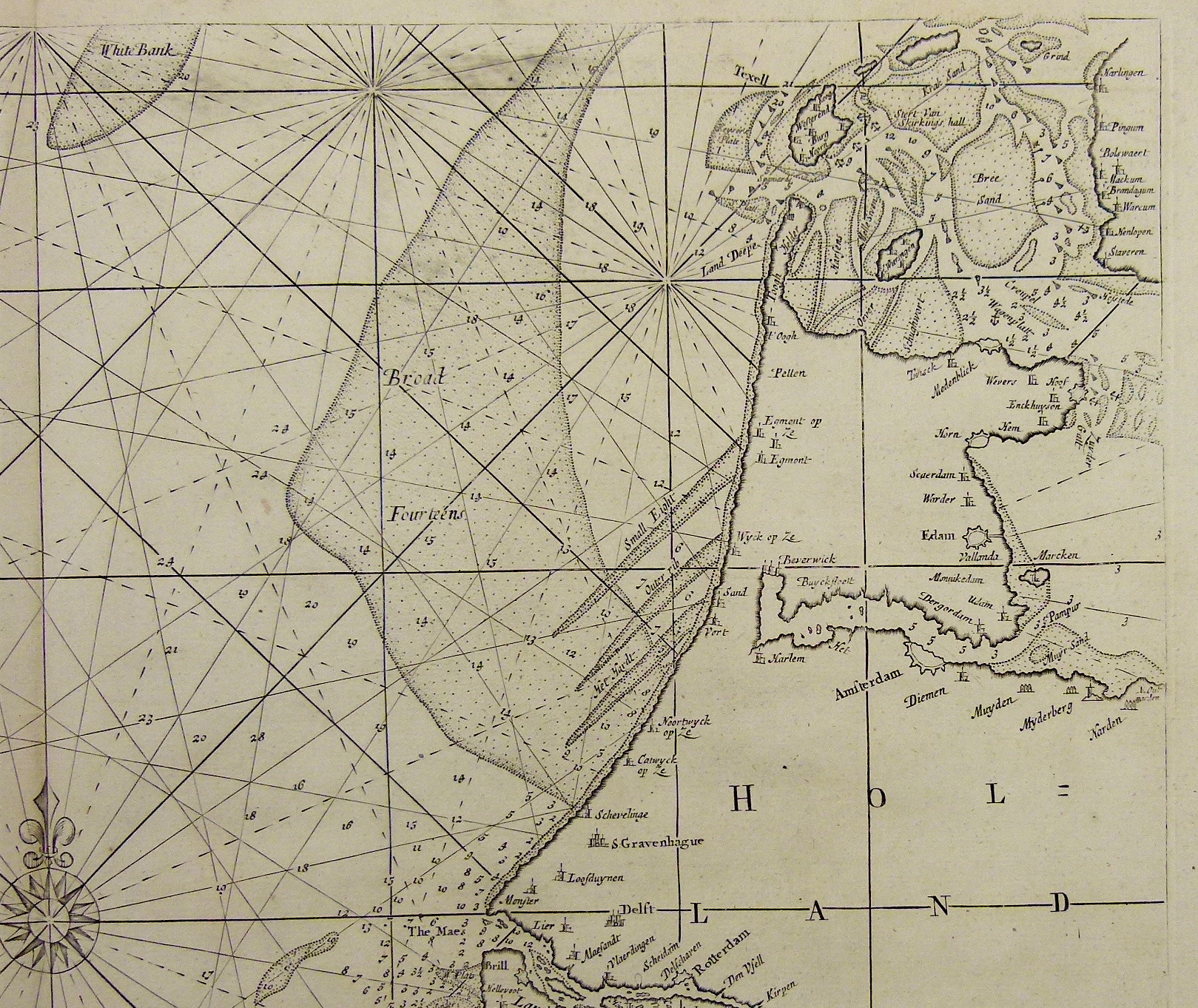
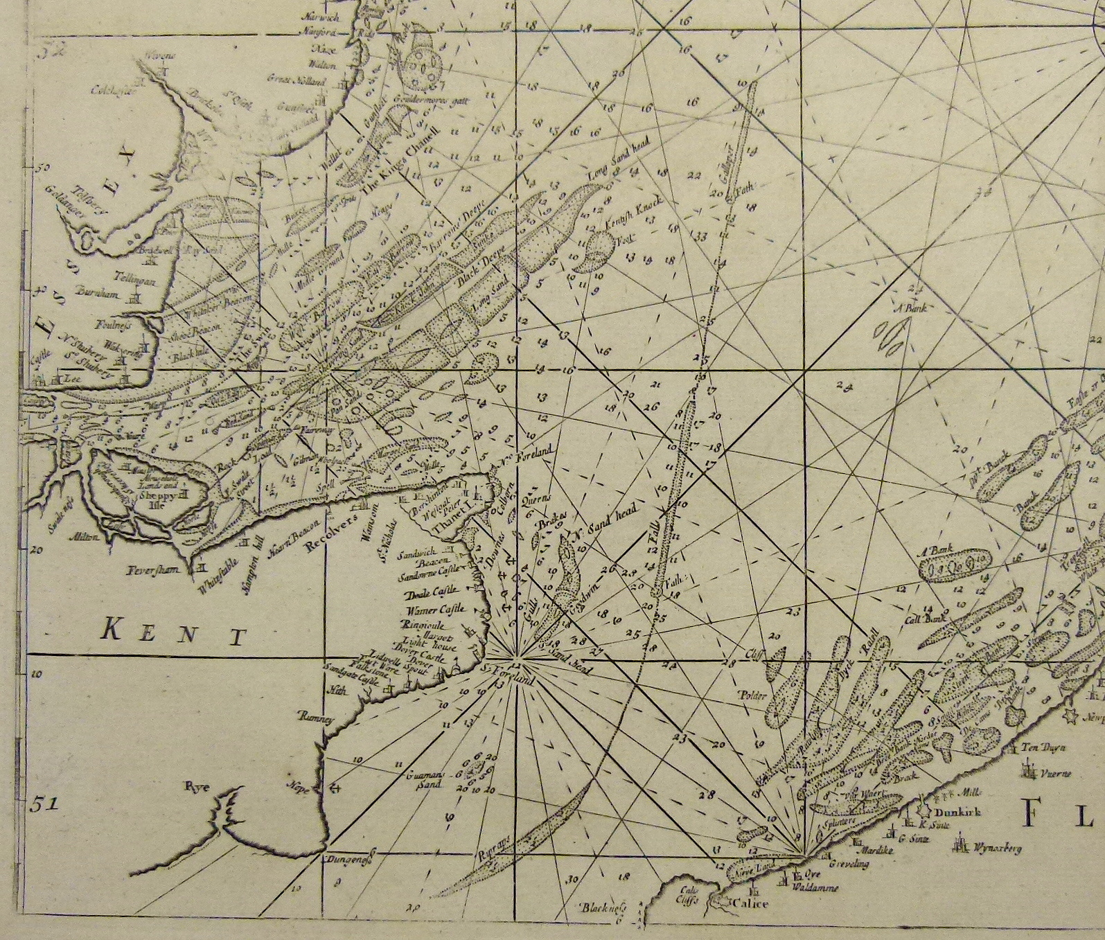
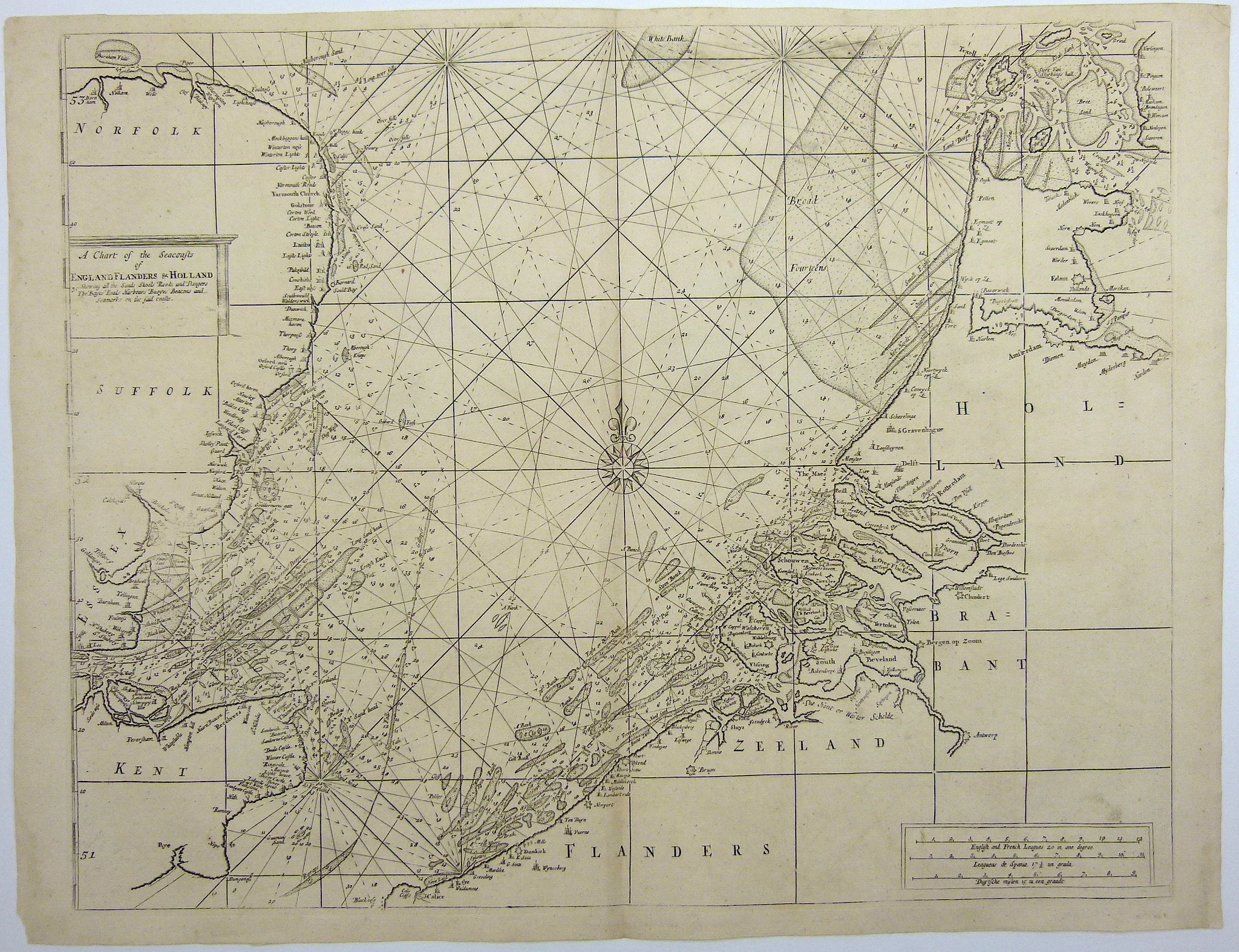
Volledige titel: 'A chart of the Seacoasts of England, Flanders and Holland shewing all the sands shoals rocks and dangers, The Bayes, Roads, Harbours, Buoyes and seamarks on the said coasts.'
Met schaalverdeling, kompasroos, koerslijnen en opvallend gedetailleerde weergave van dieptematen en zandbanken.
Afmeting prent: 42,5 x 52. Afmeting papier: 47 x 61 cm.
Kopergravure uit 'The English Pilot. Describing the Sea-Coasts, Capes, Head-Lands... Rivers and Ports in the Whole Northern Navigation.' uitgegeven door Mount en Page te London in 1756.
De oorspronkelijke kaart is gemaakt door de carthograaf Samuel Thornton. Deze is voor het eerst uitgegeven in 1703 door zijn vader John Thornton. Deze versie zonder impressum wordt na 1715 uitgegeven door Mount & Page.
John Thornton (1641-1708) werkte aanvankelijk mee aan de John Seller's uitgaven van zijn 'The English Pilot or Sea Atlas'. Hiermee probeerde Seller de concurrentie aan te gaan met gerenommeerde Amsterdamse uitgeverijen als Janssonius en Van Keulen.
The chart was initially drawn by Samuel Thornton, who inherited the English Pilot plates from his father, John Thornton. A few known examples of this map have the Samuel Thornton imprint below the title. This suggests that it was first issued for John and Samuel Thornton's 1703 issue of the English Pilot, Third Book. The present example has the cartographer's name removed, thus it likely postdates the 1715 Richard Mount and Thomas Page takeover of the work.
The English Pilot was an important British sea-atlas published from 1671 to 1803. Initially published by John Seller, publication of the atlas changed hands periodically, with other publishers including Charles Price, John Thornton, and the Mount & Page firm. The charts from the English Pilot were intended as working charts so there was an effort to make them accurate.
Deze prent wordt u aangeboden door Gouldmaps. Wij bieden originele antieke kaarten en natuurhistorische prenten van hoge kwaliteit. Wij zijn verheugd dat wij in de webwinkel van de Toverkamer een kleine collectie kaarten een prenten kunnen tonen. Als u meer vragen heeft over een kaart of prent, neem dan gerust contact met ons op: [email protected].